Please allow us to share some important hiking tips. Stewardship of the environment is everyone’s responsibility. Please help us protect and preserve our home so future…
Buena Vista & Salida, Colorado
Hiking & Backpacking
Rimmed by the mighty Sawatch, Mosquito and Sangre de Cristo mountains, Chaffee County is a breathtaking place to get outdoors. Like sentinels lining the horizon to the west, Sawatch peaks dominate the Upper Arkansas Valley. Running some 100 miles, from south of Salida to north of Leadville, 15 of Colorado’s 58 14,000-foot peaks rise in the Sawatch. The range features four of the state’s five tallest peaks including Mount Elbert, at 14,440 feet the state’s highest and second only to California’s14,505-foot Mount Whitney in the lower 48. The Collegiate Peaks – five mountains named after colleges – are included in the Sawatch. View Interactive Hiking Map
Hiking & Backpacking In Buena Vista & Salida, Colorado
Rimmed by the mighty Sawatch, Mosquito and Sangre de Cristo mountains, Chaffee County is a breathtaking place to get outdoors. Like sentinels lining the horizon to the west, Sawatch peaks dominate the Upper Arkansas Valley. Running some 100 miles, from south of Salida to north of Leadville, 15 of Colorado’s 58 14,000-foot peaks rise in the Sawatch. The range features four of the state’s five tallest peaks including Mount Elbert, at 14,440 feet the state’s highest and second only to California’s14,505-foot Mount Whitney in the lower 48. The Collegiate Peaks – five mountains named after colleges – are included in the Sawatch. View Interactive Hiking Map
Sawatch Mountain Range
Running from north of Leadville to southwest of Salida, the Sawatch Range consists of 15 peaks of 14,000 feet or more including Mt. Elbert, at 14,440 feet the highest in Colorado and second highest in the lower 48 states. The Collegiate Peaks, named after five famous universities, are a part of the range.
Sangre de Cristo Mountain Range
Running south from Poncha Springs to Santa Fe, New Mexico. This portion of the Rocky Mountains is the southernmost subrange. A wilderness area and multiple 14,000-foot peaks are located here, as well as the Great Sand Dunes National Park and Preserve.
Mosquito Mountain Range
Alpine tundra, adjoining forests and rare plant species are found in this area northeast of Buena Vista. The Mosquito Range features five fourteeers: Lincoln, Bross, Democrat, Cameron and Sherman. It is also home to the highest vehicle route in the country, Mosquito Pass, cresting at 13,185 feet.
Leave No Trace
Boreal Toad, the 200+ year old Krumholtz fir trees at timberline, and an extensive list of aquatic and land species? Follow these guidelines to help keep these creatures and plants thriving, and ensure other backcountry adventurers have a positive experience:
- Do not collect firewood for campfires
- Camp 200 feet from any water source and 100 feet from any trail
- Use existing backcountry campsites, and make sure you are camping on durable surfaces
Pack it in, Pack it out
Pack out your trash and human waste. Our local gear stores carry human waste bags. We all appreciate not seeing the invasive non-native toilet paper flowers and what is underneath
Video
Experiences
The Ten Essentials
Navigation, Insulation, Illumination, Personal Protection, Fire, Signaling Devices, Repair kit and tools, Nutrition, Hydration, Emergency shelter.
Hiking and climbing at 14,000 feet is no joke
Do Your Research
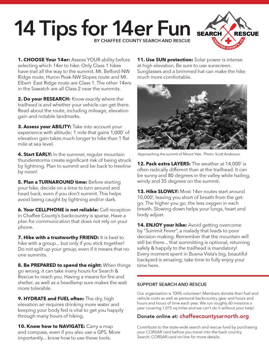
Most of the fourteener routes involve Class 2 scrambling or climbing. Only a few fourteeners have hiking routes to the summit. Determine your route based on your ability and others in your group. Roads to the trailhead can oftentimes be a journey on their own, so make sure your vehicle can safely travel to the trailhead. Check the weather forecast ahead of time and plan appropriately.
Make a Plan
Summertime in Colorado’s high country means afternoon thunderstorms, so check the weather beforehand, plan an early start, have a group turnaround time, and be back below tree line by noon. Cell service is spotty to non-existent in the backcountry, so plan for alternative communications. Remember, summiting is optional but returning to the trailhead happy and safe is mandatory!
Pack the Right Gear
The old saying goes that if you don’t like the weather in Colorado, then wait five minutes. The weather at 14,000 feet can be radically different than at the trailhead, so make sure your pack includes extra layers, plenty of water, food and the 10 Essentials to get you through an unplanned night.
The Adventure By Nature Pledge is an outreach and education project supporting outdoor recreation, economic and visitor growth in Chaffee County by encouraging responsible recreation, stewardship principles and best practices for visitors and residents recreating in the outdoors.
We believe that stewardship of the environment is everyone's responsibility. Please help us protect and preserve our home so future generations can enjoy it just as you have.
Local Trail Systems
Fourmile Travel Management Area
Off Buena Vista’s East Main Street, a foot and bike bridge leads to the Barbara Whipple and Midland trail systems, with routes over and around the Arkansas Hills and into the Fourmile Travel Management Area. West of town are a number of great rides starting with the Colorado Trail among a host of others.
Salida Mountain Trails
In Salida, mountain bikers have a wide variety of trails to ride right from town on Arkansas Hills or Methodist Mountain trails. Among a multitude of choices outside of town, the famed Monarch Crest Trail starts at the top of Monarch Pass and connections to the Colorado Trail are just off U.S. 50 between Maysville and Garfield.
Search and Rescue
Chaffee County has two Search and Rescue organizations. These are all volunteer organizations operating under the direction of the Chaffee County Sheriff’s Office. Their mission is to provide search and rescue services, as well as outdoor safety education, at no cost to the public.
Please consider purchasing a COSAR Card to ensure Colorado’s search and rescue teams are reimbursed for your rescue.
Chaffee County
Search and Rescue – North
P.O. Box 1671
Buena Vista, CO 81211
ChaffeeCountySARnorth.org
Chaffee County
Search and Rescue – South
P.O. Box 313
Poncha Springs, CO 81242
ChaffeeSARsouth.org
National Trail Systems
Colorado Trail
The Colorado Trail stretches 486 miles from Denver to Durango. Trail users experience six wilderness areas and eight mountain ranges topping out at 13,271 feet, just below Coney Summit at 13,334 feet. The average elevation is over 10,000 feet and it rises and falls dramatically. Users traveling from Denver to Durango climb 89,354 feet. The Chaffee County section is popular with day and overnight hikers alike.
Continental Divide Trail
The Continental Divide separates the rivers and streams that flow eastward into the Atlantic Ocean from those that flow westward to the Pacific.
The portion of the Continental Divide in the United States is about 3,000 miles long – from Glacier National Park in Montana, south through the Rocky Mountains, to the Mexico border in southwest New Mexico.
The Sawatch Range segment in Chaffee County follows the flanks of Colorado’s highest peaks, with nice stretches above timberline in portions of the Holy Cross, Mount Massive, and Collegiate Peaks wilderness areas.
American Discovery Trail
The Colorado Trail stretches 486 miles from Denver to Durango. Trail users experience six wilderness areas and eight mountain ranges topping out at 13,271 feet, just below Coney Summit at 13,334 feet. The average elevation is over 10,000 feet and it rises and falls dramatically. Users traveling from Denver to Durango climb 89,354 feet. The Chaffee County section is popular with day and overnight hikers alike.
American Discovery Trail Society
Colorado has 58 mountain peaks exceeding 14,000 feet — more than any other state in the country
The Sawatch Range consists of 15 peaks of 14,000 feet or more, including Mt. Elbert at 14,440 feet, the highest in Colorado and second highest in the lower 48 states. The Sawatch Range rises over 7,000 feet from the valley floor to the top of the Continental Divide.
Hiking Trails
Salida Trail & Trail Tales of the Earth
The Salida Trail is a great hike for people of any age along a paved path wandering through historic…
Castle Gardens
Castle Gardens hosts a maze of trails among fantastic eroded dirt cliffs – the only landform…
Behind Tenderfoot (S) Mountain
The low hills just north of downtown Salida offer a wide variety of nice hiking trails…
Rainbow Trail East
The Rainbow Trail is a long trail that stretches all the way from Silver Creek all the way down the…
Starvation Creek
The hike along Starvation Creek follows a winding mountain stream on singletrack through pine, fir…
Pass Creek Lake
The hike to Pass Creek Lake climbs to a high mountain basin and lake at treeline. The beginning of…
Fooses Creek - Colorado Trail
This hike starts at Fooses Lake and follows a rough road up the Fooses Creek drainage toward the…
Boss Lake
Boss Lake is a small reservoir set in a crown of thick forests. It’s a beautiful spot for a…
Lost Wonder Hut
Starting in the small town of Garfield, this route follows an old mining road that traces the path…
Waterdog Lakes
The trail to Waterdog Lakes is a popular hike that leads to scenic lakes beneath the Continental…
Monarch Crest Trail
The Monarch Crest Trail wanders above treeline for many miles along the spine of the Continental…
North Fork to Blank’s Cabin
This is a hike from the North Fork creek drainage on the Colorado Trail from the Angel of Shavano…
Brown’s Creek - Wagon Loop Trail
The Wagon Loop Trail circles a section of Brown’s Creek on a pleasant singletrack through pine…
Barbara Whipple Trail
Established in 1991, the Barbara Whipple Trail is a popular, historical hike with interpretive signs…
Midland Trail
The Midland Trail offers a pleasant hike that is fairly flat and follows the old Midland Railroad…
Davis Meadow Trail
The Davis Meadow Trail winds through the upper end of the Fourmile Travel Management Area northeast…
Colorado Trail South
Chalk Creek flows east from the Collegiate Peaks mountain range into the Arkansas River. This…
Agnes Vaille Falls
Agnes Vaille Falls is a popular trail for a short, pleasant hike to a beautiful waterfall. The…
Narrow Gauge Trail
This historic hike follows an old narrow gauge railroad route of a train that ran from Nathrop to…
Alpine Tunnel
This hike follows the old railroad grade from the ghost town of Hancock to the East Portal of the…
Poplar Gulch
Poplar Gulch lies just outside historic Saint Elmo, a photogenic ghost town with many original…
Colorado Trail South Cottonwood Pass
Beautiful singletrack leads you south on the Colorado Trail from Cottonwood Pass on a rarely hiked…
Denny Creek to Hartenstein Lake
Named for turn of the century Buena Vista Lawyer, George K. Hartenstein, Hartenstein Lake sits in a…
Ptarmigan Lake
Named for the lovely ptarmigan birds, which live in the area year-round, Ptarmigan Lake sits in a…
South Texas Creek
The South Texas Creek Trail is a classic hike through high altitude tundra above treeline. The trail…
Cottonwood Pass Skyline Hike
The Skyline Hike takes you from the top of Cottonwood Pass to the quick and easy small summit to the…
Lakeside to Interlaken
Interlaken is a former resort that once rivaled the Broadmoor for being the most luxurious property…